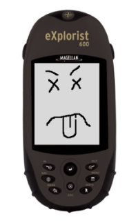
 Well, the good news is that after calling their support line and trying the three-button-reset ritual that I hadn’t known about, my Magellan eXplorist 600 is still completely dead. They did not give me any hassle about replacing the unit, they just gave me an RMA number. My dead eXplorist was sent to their “Repair” center in Fort Worth, TX this afternoon. A replacement should arrive in about a week to a week-and-a-half.
The bad news is that Magellan has discontinued the $350 eXplorist 600 (and the rest of the eXplorist line) and insists that they can only offer their newer $250 Triton 500 as a replacement. I’ll withhold judgement on whether to be ticked off at the $100 of retail value that is being lost here until I see the specifications. It looks at first glance that the basic capabilities really are pretty much the same, so it may turn out okay…except for the most important feature by far, which I originally chose the eXplorist for in the first place: documented data formats.
The Triton series GPS’s appear to use a bizarre, undocumented file format, completely different from the documented format of the Meridian and eXplorist models. This means that as of right now, a Magellan Triton owner is not permitted to work with their OWN DATA without going through a proprietary, Microsoft-Windows-only GUI package, which ironically apparently uses GPSBabel to do file conversion. GPSBabel doesn’t support the Triton formats since there is no information available on how to read and write them yet. Since I have no Microsoft Windows machines anywhere, this means the shiny new Triton 500 (which I – seriously – can’t stop thinking of now as the “Magellan Vista”) will be nothing more than a highway map that requires batteries unless their proprietary “VantagePoint” software will run under WINE.
I’m hoping that they’ve merely been busy and will soon get around to adding this units specifications to their “Interface Solutions” information. This is where the openly-published file format (and communication protocol) specifications which were highly (and rightfully) praised by the GPSBabel project are made available for the now-abandoned Meridian and eXplorist units. If the GPS data I work so hard to obtain remains locked inside the proprietary format, only accessible at the whims of Magellan and Microsoft, I’m going to be extremely peeved. If, on the other hand, GPSBabel soon gets the information necessary to add support for the Magellan Triton line, the only serious complaint I have with all this will go away. Honestly, if I can at least get enough documentation to write my own simple waypoint, track, and route reader for their Triton files I’ll be happy.
I think a real, old-fashioned letter, printed on dead tree and everything, mailed to their corporate HQ is called for…
Anybody out there have any experience dealing with Magellan corporation? I’d like to think they want to do the right thing…
 Well, the good news is that after calling their support line and trying the three-button-reset ritual that I hadn’t known about, my Magellan eXplorist 600 is still completely dead. They did not give me any hassle about replacing the unit, they just gave me an