Was it a mistake to buy Magellan GPS? Stay tuned…

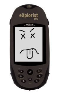
A dead Magellan eXplorist 600 GPS unitWell, the good news is that after calling their support line and trying the three-button-reset ritual that I hadn’t known about, my Magellan eXplorist 600 is still completely dead. They did not give me any hassle about replacing the unit, they just gave me an RMA number. My dead eXplorist was sent to their “Repair” center in Fort Worth, TX this afternoon. A replacement should arrive in about a week to a week-and-a-half.

The bad news is that Magellan has discontinued the $350 eXplorist 600 (and the rest of the eXplorist line) and insists that they can only offer their newer $250 Triton 500 as a replacement. I’ll withhold judgement on whether to be ticked off at the $100 of retail value that is being lost here until I see the specifications. It looks at first glance that the basic capabilities really are pretty much the same, so it may turn out okay…except for the most important feature by far, which I originally chose the eXplorist for in the first place: documented data formats.

The Triton series GPS’s appear to use a bizarre, undocumented file format, completely different from the documented format of the Meridian and eXplorist models. This means that as of right now, a Magellan Triton owner is not permitted to work with their OWN DATA without going through a proprietary, Microsoft-Windows-only GUI package, which ironically apparently uses GPSBabel to do file conversion. GPSBabel doesn’t support the Triton formats since there is no information available on how to read and write them yet. Since I have no Microsoft Windows machines anywhere, this means the shiny new Triton 500 (which I – seriously – can’t stop thinking of now as the “Magellan Vista”) will be nothing more than a highway map that requires batteries unless their proprietary “VantagePoint” software will run under WINE.

I’m hoping that they’ve merely been busy and will soon get around to adding this units specifications to their “Interface Solutions” information. This is where the openly-published file format (and communication protocol) specifications which were highly (and rightfully) praised by the GPSBabel project are made available for the now-abandoned Meridian and eXplorist units. If the GPS data I work so hard to obtain remains locked inside the proprietary format, only accessible at the whims of Magellan and Microsoft, I’m going to be extremely peeved. If, on the other hand, GPSBabel soon gets the information necessary to add support for the Magellan Triton line, the only serious complaint I have with all this will go away. Honestly, if I can at least get enough documentation to write my own simple waypoint, track, and route reader for their Triton files I’ll be happy.

I think a real, old-fashioned letter, printed on dead tree and everything, mailed to their corporate HQ is called for…

Anybody out there have any experience dealing with Magellan corporation? I’d like to think they want to do the right thing…

I guess now I find out how good or bad Magellan, inc. is.

A couple of months ago I traded up from my Garmen etrex Legend to a Magellan eXplorist 600. I wanted to get away from Garmin due to a couple of irritating limitations that they seem to cling to (like losing your timestamps if you save an individual track, lack of SD card support, and dropping NMEA data support “to support [their] software” [see the review in Make #1]). So far, I’ve been pretty pleased with the shiny new Magellan. Though their software (as usual) only works on Microsoft Windows, I didn’t buy it for the software, and GPSBabel handles the data conversion of the files just fine.

So, naturally, now that I’ve just started blogging with the track data I’ve been recording with it, it has died on me. Yesterday – worked fine. Today – won’t turn on or respond in any way.

The good news is that I DID register the thing online at Magellan corporation’s website, and it’s supposed to have a 1-year warranty. Support’s only available Monday-Friday, though, so I’ll have to wait until Monday to see a response to my support query. Wish me luck. I’ll post updates in case anyone is interested in how Magellan responds.

In other news, “BigC” followed up on my previous queries about digital microscopes and Linux, saying that the manufacturer is now offering a Linux-compatible version of their AM311S model (the Linux-compatible one is the “AMU311S”) by special-order. Only goes up to 200X magnification, though, so it’s not real useful for my microbiological purposes. I can’t say the manufacturer of these digital scopes is impressing me much, but BigC certainly seems to be going out of their way to give good service.

There’ll be at least one other post later today – I wanted to get some more “classic” microbiology papers blogged before the day was up. Kirby-Bauer or Schaeffer-Fulton?…

Another cheatin’ “Open Thread” and random stuff

No single topics to dominate a post today. I’m in a hurry (as usual lately) and have very little time. Tomorrow morning I’m back on the 1600-mile route back to Southeast Texas, hopefully to sign the closing paperwork on the house we’re trying to buy.

My Mountain Dew® Wine appears to be still sitting there after several hours. Either the benzoic acid is still inhibiting the fermentation (in which case it’ll go REALLY slowly) or the yeast is just in shock or something. We’ll see how it looks in the morning. I’ll leave it for a week or so anyway to see how it does. Meanwhile I’ll refrigerate the other batch of yeast culture until I get back. If I have to develop my own strain of “Mountain Dew Yeast” I will, dagnabbit!

I did get a chance to go for a quick walk in the Big Room on the way back from some errands yesterday, so it gives me an excuse to play with the wordpress map plugin again (RSS feed readers: the map doesn’t get inserted there. Please check out the interactive map at the blog’s website here.) Comments on the map (or anything else, really – I DID say “Open Thread” after all) are encouraged – what do you think? I’d like to do some audio content for points on a map at some point, too. Maybe some video.

Lava Rock Walk [height=560;width=560]

If anyone’s bored enough to want to see how I get from Southeast Idaho to Southeast Texas, I can post a map of that tomorrow, too…

Well, a PHP example, anyway

Once I dove in and started messing around, I only had to fix two typos as the example I was working on seems to work correctly, at least to the extent that I’ve tested it. I now have what appears to be a working example of Geostring parsing in PHP. In this case, the example reads my feed from the Twitter website, sifts out any geostring tags it finds, then generates Google Maps links for each one found. As I write this, there are two geostring tags on that page, representing places (and times)
that I have actually been, and it seems to work.

You can take a look at the source code for the example here, or see it in action here.

Feel free to grab a copy to play with if you’d like (or write one yourself that isn’t so messy – hey, as someone who doesn’t consider himself a professional “coder”, I’m just happy that it did exactly what I wanted it to do on the first try…). You should only need to worry about two things – changing the $text_to_read, and whether or not your web server (or CLI) has fopen wrappers turned on so the script can read another web page if you use a web page as your text to parse rather than a local file.

Since generating a geostring tag is trivial, I didn’t bother trying to incorporate that into this example. If you want one, then here:

<?php
//generate a geostr tag with the most typical information only
//point not part of a track nor including heading or angle
$lat=44.027168;
$lon=-111.297892;
$elev=”1711.9m”; //could leave off the “m” and treat as float, since it defaults to “meters”
$timestamp=”20071125T123438-06″; //6 hours behind UTC

print(“geostr:$lat,$lon,$elev:$timestamp:geostr”);
//”full” version: print(“geostr:$lat,$lon,$elev:$timestamp,:,:geostr”);
//completely unnecessary, but legal
?>

As always, comments and suggestions are welcome.

New toy: “Twitter”

Wow – Celestron takes 8 business days to get me a terse one-sentence answer. BigC responds in one. Impressive. Apparently their technical people are all at trade-shows at the moment so my bigger question will have to wait until they get back, but they were at least able to answer my question about their “tabletop” digital microscopes magnification (answer: the “600x” really is optical magnification, not digital.)

Another digital microscopy WANT/DO NOT WANT post to follow when I get the followup reply. Meanwhile, after hearing about it on the This Week in Tech podcast for a while, I finally talked myself into signing up to play with the coincidentally named Twitter system.

Twitter logoIt sounds like a really stupid idea – “Oh, goodie, now I can broadcast ‘text messages’ no more than 140 characters long about trivial events in my life to the whole world! Whoopee!” “Wow! I can find out when random strangers are drinking coffee AS IT HAPPENS!” Thrills! Excitement! Adventure!…

On the other hand, having the messaging system watch for particular words might be a handy way of monitoring current events. Plus, there seems to be a lot of potential for fun, off-the-wall uses, even if many of them are kind of silly.

It DOES seem like kind of an ideal context to play with that “geostrings” concept I’ve been toying with. A terse, easily-machine-parsed format for geotag data that can fit into a “twitter” post and still leave room for a sentence or two to go with the geographic information seems like it might be useful. If you’re so incredibly bored that you want to see some examples, you can check out my own Twitter posts, several of which I’ve embedded geostrings into.