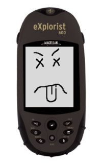
 Here’s a “fun” situation: take a Magellan-brand handheld GPS unit with a fresh set of batteries on a 10.2 mile hike over very rough terrain, having it record a track so that all the nifty pictures along the hike can be geolocated and the course of the hike can be mapped later. After a gruelling 8 hour trek, tell the unit to save the track. Watch in annoyance as it starts to save to the SD card but then complains “EXTREME LOW BATTERY – SHUTTING DOWN”. Just annoyance though – previously when it has done this, it merely loses the last few minutes of track, and you can replace the batteries and re-do the save when it comes back up. Except this time, when instead of actually shutting down it seems to restart itself, complain of “Low Battery”. Then throw a fit when I try to get the fool thing to actually shut down, watching in horror as it restarts itself a few times for no good reason before finally fading out. Then replacing the batteries and screaming with rage when the unit comes up with the same messages it did the very first time it was turned on…despite somehow keeping a copy of the “Points of Interest” I’d put in before, it has eaten not only all of my settings but also the entire friggin’ 10.2 mile track that I was trying to save!
Moral of the story: Magellan=BAD. Between bad hardware and the newer participant-hostile “consume-only” business model they’ve gone to with the new “Triton” line, I wouldn’t recommend them to anyone (unless I secretly hated them.)
So, I decided to cool off by hacking into NASA’s feed to one of the Mars Rovers to have it take a picture for me:

You don’t believe that I really hacked NASA, do you…well, read on:
Okay, sure, it’s just one of the photos I took on the hike with the blues and greens drained out of it (and the plants cropped out of the bottom of the picture), but the scene really did remind me of Mars Rover imagery. Despite Magellan’s pathetic track-destroying tantrum, I was able to work out locations for some of my photos from a few that my Minister of Dometic Affairs (and household Rocktologist) took with her G1 phone.
Therefore, below you should see a map of the volcanic vent at “Hell’s Half Acre” in Southeastern Idaho, with a few pictures on the map. If you want to, you should be able to click on the medium-sized pictures in map’s popups for each one to go to larger versions of the images.
You can also directly download the KML file [width=540;height=580] for viewing in Google Earth or other KML-aware programs like Marble if you’d like to.
In addition to some very impressive recent volcanic geology strewn with intermittent colorful flora like lichens, there’s also a cache to visit. I found it and signed the logbook.